Bukhansan for Beginners: Which Easy Trail to Pick and How to Get There
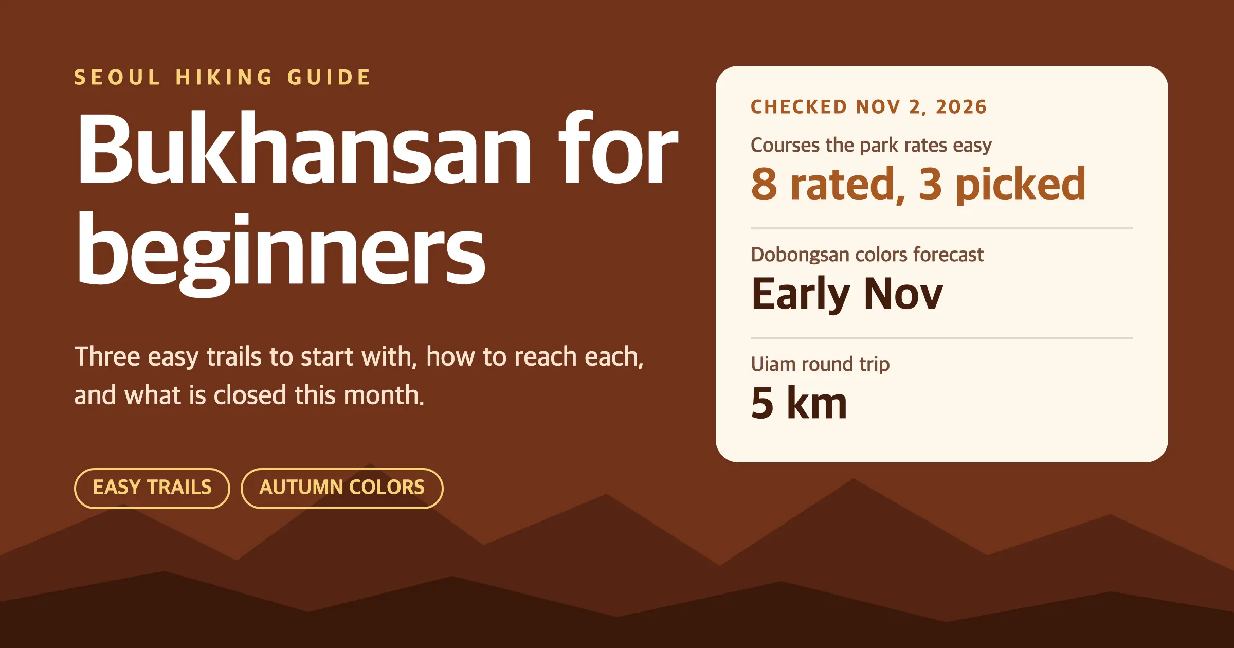
Bukhansan for beginners comes down to eight courses that the Korea National Park Service (국립공원공단) rates easy. They sit in Bukhansan National Park (북한산국립공원), which covers two mountains: Bukhansan and Dobongsan (도봉산).
From the park service’s course pages I picked three of them: Uiam on the Dobong side, and Daenammun and Bogungmun on the Bukhansan side. I’d walk Uiam on a free morning this week, and Daenammun on a full day.
Bukhansan for beginners: which trail should you pick first?
| Trail | Starts at | Park service distance and time | Level |
|---|---|---|---|
| Daenammun (대남문코스) | Bukhansanseong Visitor Center (북한산성탐방지원센터), Eunpyeong | 5.8 km, 3 hours one way | Easy (하) |
| Uiam (우이암코스) | Dobong Visitor Center (도봉탐방지원센터) | 5 km, 2 hours 20 minutes round trip | Easy (하) |
| Bogungmun (보국문코스) | Jeongneung Visitor Center (정릉탐방지원센터) | 2.4 km, 1 hour 20 minutes one way | Easy (하) |
| Bibong (비봉코스) | Bibong Visitor Center (비봉탐방지원센터) | 2 km, 1 hour one way | Moderate (중) |
| Baegundae (백운대코스) | Baegundae Visitor Center (백운대탐방지원센터) | 1.9 km, 1 hour 30 minutes one way | Moderate (중) |
Checked November 2, 2026 on the park service’s Bukhansan course pages. The levels are its own 하 (low) and 중 (middle) ratings. Daedongmun (대동문), also rated low, is left out: its page says easy in the header and medium in the text. Uiam’s row uses the page’s walking notes, because its header shows a shorter distance.
Shorter isn’t always easier. Bibong takes only an hour, yet the park service rates it moderate, and its summit is reserved for people carrying a helmet, rope and descender. Baegundae ends in steep, wire-rope sections. Save both for a second trip.
Uiam’s time is a round trip and the others are one way. Walk Bogungmun both ways and it comes to about 4.8 km, close to Uiam’s 5 km.
Four more easy courses are on the Dobong side: Obong, Sapaesan, Mangwolsa and Sinseondae. They have the same rating, but I haven’t checked them, so they aren’t in the table.
Match the trail to your day: Uiam for a morning, Daenammun for a full day, Bogungmun if you’re staying near Line 4.
Where can you still catch autumn colors?
The park service’s Dobong office posted on October 16 that Dobongsan (도봉산) should peak in early November. That is a forecast for the whole mountain, not for one trail, and Uiam sits on it. I found no matching forecast for the Bukhansan side, where Daenammun and Bogungmun start.
The Daenammun course page calls it a route worth seeing in leaf season, but it gives no dates. The Uiam page leans the other way: it recommends that trail mainly for spring azaleas, though the lookout deck near the top shows Dobong’s peaks all year.
Forecasts move, so open the park’s Bukhansan news page the morning you go.
How do you get to each trailhead?
The park service lists these routes for each trail. Use them as a starting point, not a timetable.
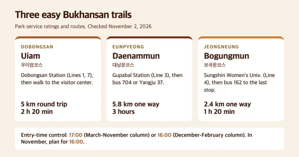
- Uiam: Dobongsan Station (도봉산역, Lines 1 and 7), then walk toward the mountain to the Dobong Visitor Center. No bus is listed.
- Daenammun: Gupabal Station (구파발역, Line 3), then bus 704 or Yangju 37 to the Bukhansanseong Entrance stop (북한산성입구). The visitor center sits at 45 Daeseomun-gil, Eunpyeong (서울시 은평구 대서문길 45).
- Bogungmun: Sungshin Women’s Univ. Station (성신여대입구역, Line 4), then bus 162 to the last stop, near the Jeongneung information center (정릉탐방안내소).
Bus numbers and stops change. Type the trailhead name into Naver Map or KakaoMap and confirm the bus the day before.
What time do you have to start walking?
Bukhansan uses an entry-time system. The park service’s table lists 04:00 as the entry time for these trails, plus a control time that changes with the season.
The control time is 17:00 from March to November and 16:00 from December to February. The Jeongneung-to-Bogungmun and Bukhansanseong-to-Daenammun routes appear in the table. The table has no row for the Dobong Visitor Center start, but the Uiam rows it does list carry the same hours.
There is one catch. The table’s column headings call winter December to February, while a caption on the same page says November to March. I take the control time to be the latest you may start up a trail, so I’d treat 4 pm as the cutoff in November and plan to be walking by midday.
Is anything closed right now?
Two closures I found matter here. The Gucheon valley trail (구천계곡), from the Academy ranger post (아카데미공원지킴터) to just below Daedongmun, has been closed since August 15, 2025 after a landslide wrecked the boardwalk. The notice names no end date. If a map app routes you that way, pick another trail.
The second closure starts on November 15. For wildfire season the park service shuts trail sections in 18 national parks until December 15. Bukhansan has one, the Darakwon entrance to Eunseokam (다락원입구~은석암) on the Dobong side. None of the three trails above is on that list.
Check the park service’s trail-control list before you leave. Closures change faster than a blog post.
Which mistakes are easy to make on these trails?
- Daenammun is long. The park service calls it easy for Bukhansan but long. It says to wear proper boots and carry poles. The hardest stretch is the roughly 500 m Nodeulbawi climb just before the gate (노들바위).
- Winter ice. The Daenammun and Baegundae pages both say the trails have many icy sections in winter and crampons (아이젠) are a must.
- Uiam has ropes. A few sections use a rope, and the park service says strollers and wheelchairs can’t manage the route. About a kilometer past Cheonjinsa temple (천진사), a sign sends you around a steep cliff. Follow it, and watch for rockfall.
- Bogungmun’s stone steps. The park service says many hikers sprain or break an ankle on them. The mushroom-shaped Cheongsu restroom (청수화장실) partway up is the last toilet before Bogungmun.
- A wrong turn at the flat rock. At Neopjeok-bawi (넓적바위), left is Bogungmun and right is the Kalbawi ridge (칼바위능선). The park service calls Kalbawi so rugged that beginners should pick Bogungmun instead.
Plan the way down before you start. The table’s times for Daenammun and Bogungmun are one way, and the Uiam and Bogungmun pages both tell walkers to plan around sunset.
My pick for this week
If I had one free morning this week, I’d take the subway to Dobongsan Station and walk Uiam. It sits on the mountain with a published peak forecast, it needs no bus, and the park service calls the Cheonjinsa-to-Uiam stretch the easiest for beginners.
For a full day, I’d pick Daenammun. It is long, but the park service calls it gentle enough for children and singles it out for leaf season. Bogungmun is my pick if the Line 4 side is closer to where you’re staying, and the park service steers beginners there instead of the Kalbawi ridge.
What else to read for a November trip
- Planning more days around the city? Seoul Festivals in November 2026 lists events and easy day trips.
The short version
The park service rates eight Bukhansan courses easy, and Uiam, Daenammun and Bogungmun are the three I picked. Dobongsan’s colors were forecast to peak in early November, so I’d walk Uiam this week and check the closure list before you leave.
Some links on Haamoni may be affiliate links. If you buy through one, I may earn a small commission at no extra cost to you. As an Amazon Associate I earn from qualifying purchases. Trail ratings, closures and entry times were correct when I checked and can change, so confirm with the park service before you go.
Sources
- Korea National Park Service: Bukhansan course guide and difficulty (북한산국립공원 코스별난이도)
- Korea National Park Service: Bukhansan transport guide (교통편 안내)
- Bukhansan Dobong Office: Dobongsan autumn foliage news, October 16, 2026 (울긋불긋, 도봉산의 단풍소식!), listed under Bukhansan visit news
- Korea National Park Service: Entry-time system by trail, Bukhansan (입산시간지정제)
- Korea National Park Service: Bukhansan trail control information, Gucheon valley partial closure (탐방통제정보)
- Korea National Park Service: Notice on autumn wildfire-season trail closures, November 1, 2026 (2026년 가을철 산불조심기간 탐방로 출입통제 공고)